
Average Salary in Japan: Minimum Wage and Cost of Living
Understand the average salary in Japan, minimum wage, take-home pay and purchasing power to assess income and living costs before moving.
To prepare for the Kumano Kodo, choose the Nakahechi if you are discovering the region: this route combines mountain walking, stopover villages and visits to the Kumano shrines. Book your accommodation before setting the hiking days, then organise trains and buses around those bookings.
In the Kii Peninsula, difficulty does not depend solely on distance. Climbs, damp steps, the weight of your backpack and opportunities to restock are equally important. A short walk towards Hongu can offer a well-rounded introduction to the pilgrimage; continuing to Nachi requires more thorough preparation.
In brief
The Kumano Kodo refers to a network of historic trails, not one single path that must be walked from end to end. These routes cross the Kii Peninsula and lead to the region’s sacred sites, including Kumano Hongu Taisha, Kumano Hayatama Taisha and Kumano Nachi Taisha.
UNESCO added the “Sacred Sites and Pilgrimage Routes in the Kii Mountain Range” to the World Heritage List in 2004. This recognition concerns a cultural ensemble combining landscapes, places of worship and routes: it does not mean that every present-day section has the same features or access conditions.
The Nakahechi is relatively straightforward to organise, thanks to its stopover villages, traditional accommodation and transport options. It also allows you to adjust the ambition of your trip: walking from Takijiri-oji, choosing a section towards Hongu or extending the experience to Nachi are very different projects.
Easy to organise does not mean easy to walk. The start from Takijiri-oji includes a sustained climb, while some forest crossings require a long time on uneven ground. Someone used to urban walks therefore needs to prepare differently from a hiker who regularly walks in the mountains.
You can be self-sufficient on the classic sections, provided you know how to follow a route and anticipate your essential needs. English signage makes navigation easier, but it does not replace a downloaded map or checking official diversions; a guide can also provide cultural insight that the signs do not offer.
Kohechi links Koyasan with the Hongu area through more demanding mountain terrain. Its remoteness, passes and limited services require genuine experience of multi-day hiking: the appeal of linking major spiritual sites should not make you overlook the physical and logistical constraints.
Ohechi and Iseji explore other sides of the peninsula, with coastal landscapes playing a larger role on some sections. They are not interchangeable alternatives to the main route: access points, accommodation and the continuity of the walk must be studied area by area.
| Route | Main appeal | Point to consider |
|---|---|---|
| Nakahechi | Villages, forests and progression towards Hongu | Elevation changes and inn availability |
| Kohechi | Mountain link from Koyasan | Remoteness and high-altitude conditions |
| Ohechi | Discovering coastal areas | Careful organisation of the chosen sections |
| Iseji | Approaching Kumano from the Ise region | Variety of terrain and access points |
When choosing your hiking route, start with your actual habits: how often you go out, how comfortable you are descending, your ability to carry a backpack and how you recover after a demanding day. A modest distance on a steep, wet path can be more tiring than a long stage on even ground.
Then decide what you want to prioritise: continuous walking, discovering the shrines or staying in hot-spring villages. These aims can be combined, but not always without a transfer; the right route is the one whose constraints you understand, not the one that accumulates the most sights.
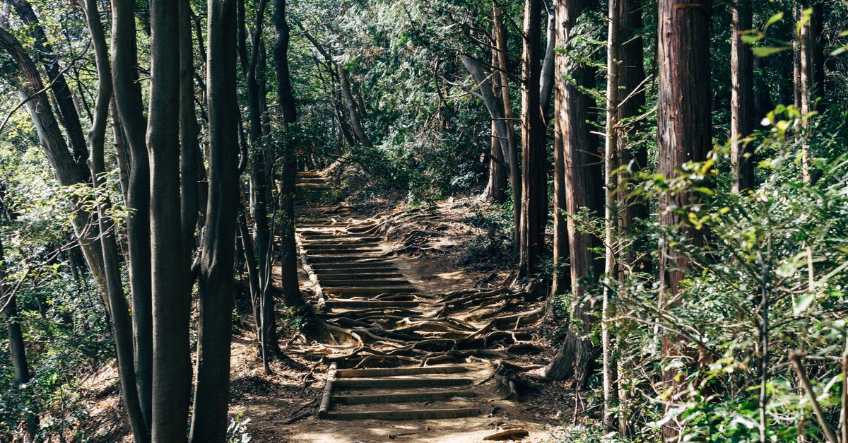
Takijiri-oji is a classic starting point for entering the mountains. Before walking, ask the local information centre about the condition of the trail and any diversions; this check also allows you to confirm that the section you have planned matches your accommodation for the night.
The route towards Takahara begins with a climb that immediately sets the tone for the trip. The village can serve as an intermediate stop, avoiding the combination of a long approach journey and an overly ambitious walking day, subject to finding an available room.
Continuing to Chikatsuyu is a more substantial effort. Allow time for breaks, slippery sections and the journey to the exact inn, which is not always beside the trail; the name of the village is not enough to calculate your arrival.
To compare route stages, use the maps and information sheets from the Tanabe tourism office. Walking-time estimates remain indicative: they do not predict your pace or the conditions you will encounter, and must be reassessed if the ground is waterlogged or you are carrying more equipment.
From Chikatsuyu, examine the route towards Hongu carefully before booking. Depending on your accommodation and how you divide the route, it may lead to a demanding day; do not automatically consider this connection a comfortable stage simply because it appears between two well-known villages.
The small shrines known as oji punctuate the path and recall its religious purpose. Taking time to observe them gives meaning to the walk, but these stops should be included in the plan rather than added to a day that has already been calculated without any spare time.
For a lighter introduction, Hosshinmon-oji to Kumano Hongu Taisha is a suitable option. This section combines wooded paths, inhabited areas and arrival at the shrine; it suits a trip focused on Hongu, provided you check the transport needed to reach the start.
When you arrive, allow time for the shrine and for Oyunohara, its former site, marked by a large torii. Visiting them without a heavy bag and without an immediate connection to catch allows you to appreciate the places more fully than adding them to the end of a day completed in too much of a hurry.
The crossing towards Nachi follows the Kogumotori-goe and Ogumotori-goe sections, with a stop at Koguchi. The walking departure for Kogumotori-goe is in the Ukegawa area: sleeping in Hongu therefore also means organising transport to the start of the trail.
This extension requires more careful preparation than the short approach to Hongu. The long forest sections and climbs make good effort management essential, while the availability of accommodation in Koguchi becomes a determining factor for the whole plan.
A bus does not allow you to leave every mountain section freely. Transport can connect some starting and finishing points, but it should not be imagined as a fallback available at any time; identify the genuine exits before setting off.
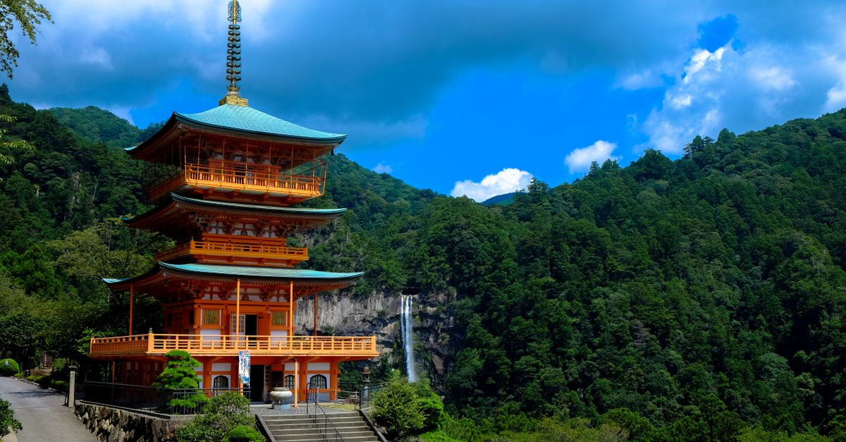
If this crossing is beyond your level, travel to the Nachi area by public transport and then discover Daimon-zaka, Kumano Nachi Taisha and the neighbouring Seiganto-ji temple. This combination preserves the cultural dimension of the trip without imposing an unsuitable continuous walk; you simply need to plan the access and return.
From Kansai, Kii-Tanabe is a practical gateway to the Nakahechi. Kuroshio express trains serve this area from Osaka; from Kyoto, look for the connection suited to your date, as the journey may require a change depending on the service chosen.
Check JR West for current timetables, reservations and fares. Avoid building your first day around a journey time found in an old travel account: the service selected and how it connects with the local bus matter more than a theoretical duration.
From Kii-Tanabe, the onward journey to Takijiri-oji is generally by bus. Check with the Tanabe tourism office and the relevant operator for the exact stop, operating timetable and payment arrangements; rural services do not offer the flexibility of the Osaka metro.
Spending the night near the station before setting off can simplify the arrangements. It gives you time to prepare your backpack, buy additional provisions and reach the start without making the walk depend on a succession of tight connections.
Hongu, Yunomine, Kawayu and Wataze belong to the same tourist area, but their accommodation is not interchangeable from a logistical point of view. An inn in a hot-spring village may require an additional journey after visiting the shrine or before the next hike.
Check the exact name of the stop closest to your accommodation, the route from that stop and any possible pick-up arrangements. A shuttle offered by an establishment must be confirmed directly: it is not a public service you can rely on without prior agreement.
For the journey to Hosshinmon-oji, organise your departure before the morning of the walk. Your chosen direction, the available bus and the location of your accommodation must form a coherent whole; setting off without checking these details can turn a short hike into a day dominated by waiting.
Keep the names of destinations in Japanese, booking confirmations and accommodation contact details on your phone. This information makes conversations with a driver or host easier, particularly when several places have similar names or mobile reception becomes unreliable.
After Hongu, travelling to Shingu allows you to discover Kumano Hayatama Taisha before continuing your journey. For the Nachi area, Kii-Katsuura is a useful base, with local connections to be checked with the operators; the arrival station and the shrine are not in the same place.
A route entering via Kii-Tanabe and leaving via Kii-Katsuura can prevent you from repeatedly retracing your steps. However, compare this arrangement with your next destination: returning to Osaka, travelling to Kyoto or continuing elsewhere in Japan does not require the same connections.
For a broader overview of Japan’s rail network, see our guide to Shinkansen tickets and reservations. The value of a Japan Rail Pass should be assessed across your entire trip, without assuming that it covers every bus used on the peninsula.
Finally, a visit to Koyasan can complement the pilgrimage without walking the Kohechi. Seasonal tourist connections should nevertheless be included only after confirming that they are operating with the official organisations: book a real connection, not an apparent proximity on the map.
Pilgrimage preparation begins with accommodation. In the villages, capacity is limited and the lack of a room can make your planned route impossible; it is better to adjust the trail before booking transport than to discover afterwards that there is too long a gap between nights.
Minshuku and ryokan allow you to stay in traditional accommodation, often with meals available on site. Services nevertheless vary: check the chosen package, type of bedding, bathroom facilities and arrival conditions rather than assuming that every inn operates in the same way. For more about this type of stay, see our guide to spending a night in a ryokan.
Kumano Travel, the booking service linked to the Tanabe tourism office, can make it easier to find a coherent sequence of stays. Sending a request does not always mean that a booking has been confirmed: wait for validation of the key nights before considering the itinerary final.
Pay particular attention to cancellation conditions if your plans include stages exposed to bad weather. A trail closure, transport change or significant fatigue may require you to revise the itinerary, and the financial consequences are not the same with every provider.
Outside the larger towns, dining options may be scarce. Ask whether the inn provides dinner, breakfast and a packed meal; booking lunch in advance avoids relying on a shop whose opening is not guaranteed.
Tell the accommodation about allergies and dietary requirements before confirmation. A family-run kitchen with limited staff may have little flexibility, and some ingredients in broths or sauces are not immediately visible; our guide to eating in Japan can help you prepare for these conversations.
Also keep emergency provisions in your backpack, regardless of the planned meal. They are useful in case of delays or an unexpected closure, while the amount of water should be adapted to the heat, the effort and the restocking opportunities you have actually identified.
Luggage forwarding can considerably lighten the walk on the sections it serves. Before choosing it, confirm the participating establishments, booking conditions, drop-off instructions and collection point; the service does not necessarily operate for every combination of stages.
Prices and arrangements change: check them directly with Kumano Travel or the relevant provider. Even with a transfer arranged, keep medication, documents, rain protection and everything needed to cope with a delay to your main luggage with you.
Your budget should distinguish accommodation, meals not included, local journeys and optional services. A room that appears cheaper may become less advantageous if it requires additional transport or does not include the meals you will need.
Keep a reserve of cash and ask establishments which payment methods they accept. Do not assume that every village has an ATM; to place these expenses within the wider trip, use our guide to the cost of living in Japan.
The hot springs of Yunomine, Kawayu and Wataze can provide a break between stages. Ask about access arrangements, the establishment’s rules and any restrictions concerning tattoos; a recovery night must also be practical to reach and compatible with the next departure.
Spring and autumn are generally the best periods for limiting discomfort caused by high temperatures. The best time to go nevertheless depends on the route chosen, altitude and your tolerance of humidity: no season guarantees dry paths in the Kii Mountains.
Summer can bring heat, humidity and heavy rainfall, increasing fatigue and making footing less secure. In winter, take account of the cold, shorter days and the risk of snow or ice at altitude, particularly on mountain routes.
Check the Japan Meteorological Agency for forecasts and alerts, then ask the local tourism office about their consequences for the trails. Favourable weather does not mean that a damaged section has reopened: the condition of the ground and the forecast are complementary pieces of information.
Our guide to Japan’s weather by month helps place this trip within a wider itinerary. For the final decision, however, prioritise local conditions over a general assessment of the national climate.
Choose shoes that you have already worn on comparable outings, with soles suited to wet surfaces. Steps, roots and stones place different demands on your feet from a road walk; testing your equipment before departure helps identify rubbing and stability problems.
A waterproof jacket, protected spare clothing and a warm layer remain useful even when you set off under a clear sky. Protect the inside of your backpack too: an outer cover alone may not be enough to keep your belongings dry during persistent rain.
Trekking poles can help on descents, provided you know how to use them without disturbing other walkers. Their main benefit is to preserve balance and distribute effort; they cannot compensate for an overly demanding route or unsuitable footwear.
Among the essential hiking advice, leaving a margin before your planned arrival is particularly important. Breaks, visits and slower progress caused by rain should fit into the day without forcing you to hurry down a slippery descent.
Tell your accommodation if a delay becomes likely and make sure someone knows your planned route. Also check that your insurance matches the activity planned, particularly regarding medical costs, assistance and any search or rescue operations.
The Kumano shrines are active places of worship, not simply points of interest on a map. Follow instructions concerning photography and accessible areas, remain discreet during ceremonies and avoid blocking passages with a bag or equipment.
In hamlets, stay on the authorised trail and take your rubbish with you, including food waste. The tranquillity of the pilgrimage also depends on respecting local residents: passing through a village does not give you access to gardens, private buildings or unmarked agricultural paths.
Yes. The section between Hosshinmon-oji and Kumano Hongu Taisha offers a focused introduction. Daimon-zaka, near Nachi, is another option, although its steps must be taken into account. Check access and the return journey before setting off.
Walking independently is possible with serious preparation, offline maps and checks on trail conditions. A guide mainly provides help with organisation and a cultural interpretation of the sites; one may be useful if you lack experience.
Only when the route reaches a road served by public transport. Long forest crossings may not have an intermediate exit. Identify the stops and confirm the timetable with the operator before relying on this option.
Start with the accommodation that determines the stages, then confirm meals, any luggage transfers and transport. A lack of availability in one village may require you to change the entire progression.
Updated on 25/10/2026
Scroll to see more articles →