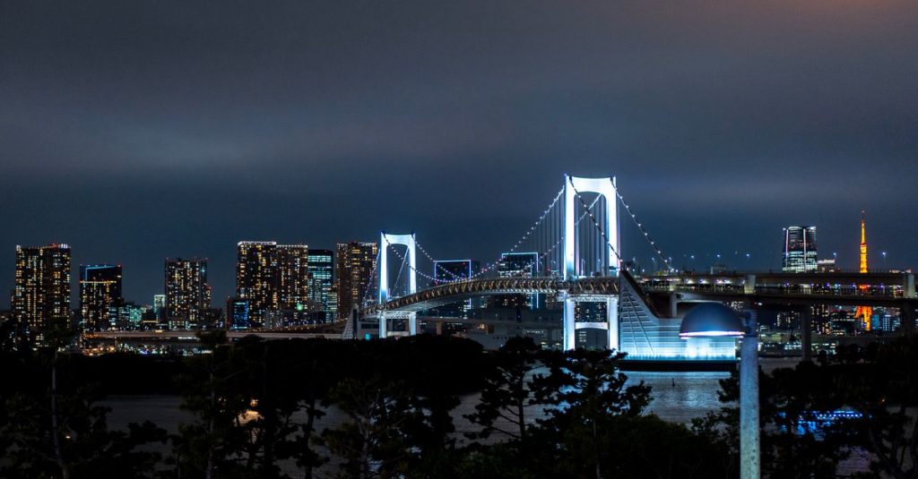
Odaiba Tokyo: Things to Do on the Artificial Island
Discover Odaiba, Tokyo’s artificial island: attractions, beaches, museums and bay views for a memorable waterfront escape in the capital.
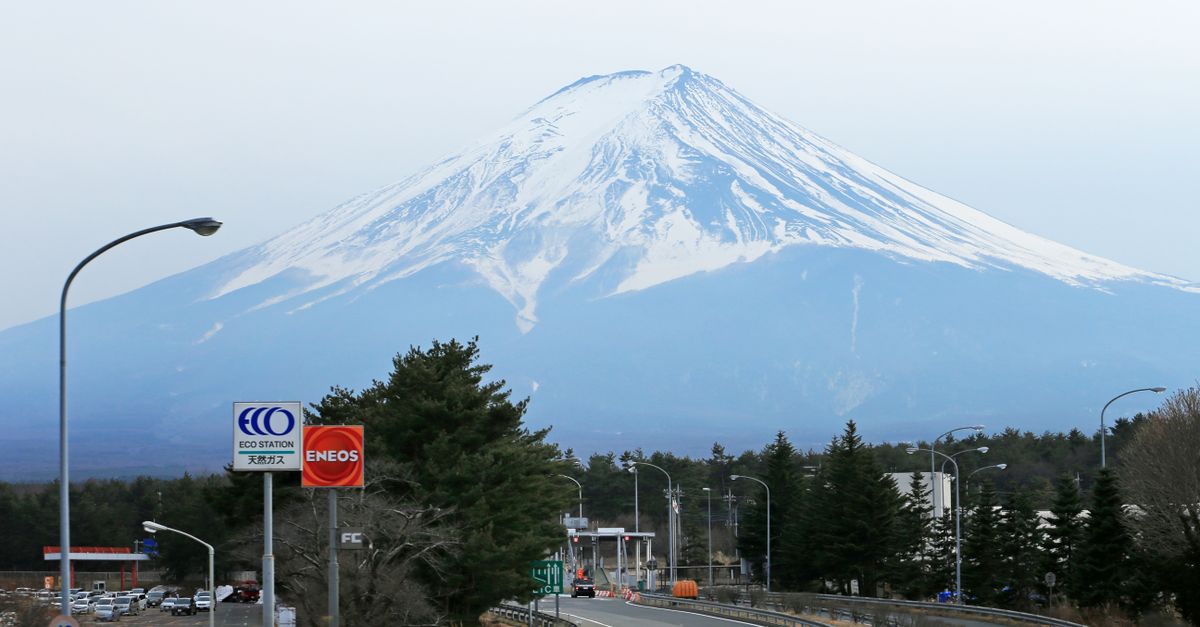
Mount Fuji reaches 3,776 metres, the altitude given by UNESCO in its 2013 World Heritage inscription dossier. This iconic Japanese summit remains an active volcano, even though its snow-covered silhouette is more reminiscent of woodblock prints than volcanic eruptions. For views, Lake Kawaguchi is a practical base, while the Chureito Pagoda offers the famous composition combining Japanese architecture and the mountain.
The best choice nevertheless depends on your itinerary: the lakes on the northern side suit trips focused on photography and walks, while Hakone and the surrounding area of Shizuoka fit more naturally into a journey towards Kyoto or Osaka. Visibility matters more than proximity: a distant viewpoint beneath a clear sky may be more rewarding than a stop at the foot of a summit completely covered by cloud. Climbing Fuji requires mountain preparation distinct from a simple sightseeing trip.
In brief
Mount Fuji’s altitude refers to its highest point, on the edge of the summit crater, not to a tourist platform. The mountain rises between Yamanashi and Shizuoka prefectures, with very different approaches depending on the side chosen. This geographical distinction explains why access, scenery and itineraries are not interchangeable.
From the lakes to the north, the view generally takes in a broad silhouette whose slopes seem to descend behind towns and forests. From the south, intermediate hills and the nearby coast create different perspectives. The same mountain can therefore appear massive, distant or almost isolated depending on the foreground.
The road-accessible altitude stations are not the summit. Their interest lies in approaching volcanic terrain and observing the landscapes below when the clouds allow it. They are not necessarily the best places to photograph the entire cone: being close can sometimes make its shape less legible.
Fuji belongs to the family of stratovolcanoes. Its structure results from the accumulation of volcanic materials, especially lava flows and ejecta, over a complex history. It was not formed in a single event, and its apparent regularity conceals older landforms and lateral openings.
Its formation is part of Japanese geology, shaped by interactions between tectonic plates and subduction. Reducing this history to a simple meeting point between plates would be misleading: magma production and ascent depend on deep mechanisms. The visible landscape is only their surface expression.
Differences in colour on the slopes are not due only to the seasons. Volcanic terrain, vegetation, erosion and snow all contribute to their appearance. At altitude, mineral surfaces dominate, while lower areas contain forests and inhabited spaces.
Snow cover varies according to weather conditions. A photograph showing a white summit does not describe its permanent appearance, just as a summer image cannot be used to assess walking conditions. When planning an outing, distinguish the desired aesthetic from the actual state of the terrain.
UNESCO inscribed Fujisan as a World Heritage Site in 2013 for its cultural value, as a sacred place and source of artistic inspiration. This recognition concerns more than a spectacular landform: it also encompasses the relationships between the mountain, religious practices, pilgrimages and the surrounding landscapes.
The works of Hokusai and Hiroshige show how the summit can structure a scene without occupying all of it. A lake, road or village gives scale to the landform. This helps when choosing viewpoints: looking for an interesting foreground is often more rewarding than simply trying to get closer.
Understanding the terrain therefore helps you organise your visit: admiring the silhouette, discovering its cultural surroundings and reaching the summit are different aims. Volcanic activity adds another essential distinction, between contemplating the landscape and understanding its risks.
Fuji is considered an active volcano by the Japan Meteorological Agency, or JMA. This classification does not mean that an eruption is imminent. It indicates that the mountain could experience renewed activity and must be monitored, even when its appearance seems completely calm.
The last generally recognised historical eruption was in 1707, mentioned in UNESCO’s Fujisan inscription dossier published in 2013. Known as the Hōei eruption, it shows that volcanic activity is not limited to the summit crater. Openings can also appear on the slopes.
The time elapsed since that event is not enough to predict the next eruption. A volcano does not follow a tourist timetable or a simple cycle that can be extrapolated. Saying that it is necessarily “overdue” or, conversely, permanently harmless would be a poor interpretation of how it works.
Volcanic eruptions can produce different effects depending on their nature and location. Near an eruptive vent, ejecta and gas emissions pose direct dangers. Other phenomena, including ashfall, can affect more distant areas depending on the wind.
Volcanic ash is not comparable to the light ash from a wood fire. It consists of mineral particles that can disrupt transport, equipment and air quality. For travellers, the consequences may therefore affect transport and accommodation even without being on the slopes.
Monitoring includes observing seismicity, ground deformation and other signs of internal activity. Visitors should not interpret any isolated signal as a prediction. Access decisions and safety instructions are the responsibility of the competent organisations and local authorities.
Check JMA bulletins and information from Yamanashi and Shizuoka prefectures before a hike or ascent. Alert status, restrictions and access arrangements may change. A transport or mountain-hut booking does not replace this check.
A live camera may show a clear summit, but it says nothing about volcanic safety. Similarly, blue skies do not rule out dangerous winds at altitude or an administrative closure. Separate information useful for photography from information determining whether an outing is authorised and sensible.
Once there, look for information signs and instructions from the managers. If an evacuation order is issued, the aim is not to reach the best viewpoint to watch the event, but to follow the indicated route. Looking for photographs must never delay a movement requested by the authorities.
For a standard visit to the lakes or nearby towns, this vigilance should remain proportionate. The aim is not to turn every excursion into an emergency, but to know whom to contact and to have a fallback option. Current official information always takes priority over an old travel account.
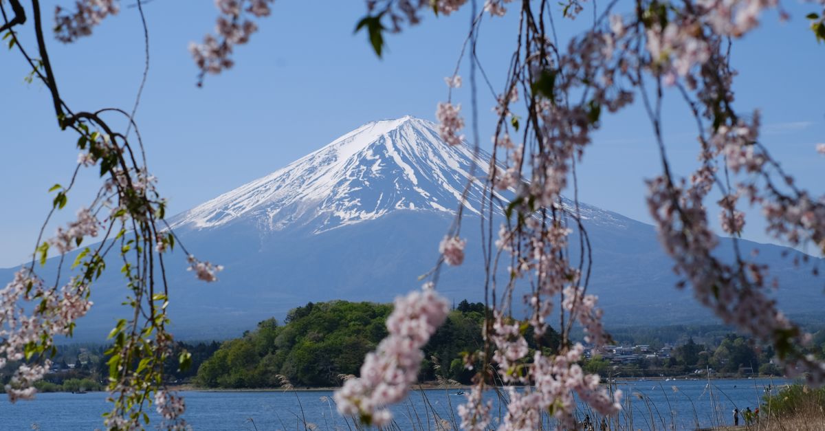
Lake Kawaguchi, also called Kawaguchiko, is particularly suited to a stay focused on observing the mountain. Walks along the shore make it easy to change your composition and look for gaps in the clouds. Accommodation and transport also make it a more flexible base than an isolated viewpoint.
The northern shore is popular for compositions combining the water with the landform to the south. The reflection nevertheless depends on the wind and the surface conditions: a perfectly visible summit does not guarantee a symmetrical image. A breeze is enough to replace the expected mirror with disturbed water.
A guide to Kawaguchiko helps you plan a stay that does not depend entirely on the weather. A walk, museum or regional meal can still be worthwhile when the summit disappears. Staying overnight also gives you more flexibility to go out as soon as a clear spell appears.
Chureito Pagoda, in Arakurayama Sengen Park in Fujiyoshida, is known for combining its red architecture with the volcanic cone. The famous view comes from a specific perspective at higher ground. It is not automatically visible from every part of the park or from the station exit.
Reaching the viewpoint requires walking uphill. If you are visiting with reduced mobility, a pushchair or difficulty using stairs, ask the manager about current possibilities before planning your visit. Crowds and any traffic-control measures should also be checked, particularly during busy periods.
Cherry blossoms and autumn foliage add a seasonal foreground, but their appearance cannot be guaranteed on a fixed date. A successful bloom, a clear mountain and low visitor numbers will not necessarily coincide. Choosing this place for its overall composition avoids making the entire visit depend on one fragile detail.
Oshino Hakkai combines spring-fed ponds, buildings and views towards the summit. Its appeal lies in this combination of water, settlement and terrain rather than in an unobstructed panorama from every pond. Shops and visitor numbers are part of the experience: this is not an isolated wilderness area.
Lake Motosu offers a view more focused on the lakeside landscape. You should nevertheless choose your observation area carefully, as the shores, roads and nearby hills alter the opening towards the mountain. Its atmosphere may feel more remote, without guaranteeing peace and quiet at every hour.
These places are not as easy to combine by public transport as they appear on a map. Connections, waiting times and walking between stops can take up a substantial part of the day. Adding Motosu to an already busy programme around Kawaguchiko may mainly reduce the time actually spent outdoors.
If departing from Tokyo, choose a main area and then a supplementary visit compatible with the available transport. A compact itinerary leaves time to wait for a clear spell; a succession of journeys, by contrast, turns every delay into a missed panorama.
Hakone suits travellers who want to combine volcanic landscapes, museums, walks and hot-spring baths. Views of Fuji are a valuable bonus, but should not be the sole reason for the stay. Intermediate mountains and clouds can hide the summit even when conditions seem pleasant beside the lake.
At Lake Ashi, the composition varies according to the shore and direction. A photograph combining the water, a torii and the mountain requires a suitable location; it is not a continuous view from the whole shoreline. Boat travel on the lake also depends on operating conditions, which should be checked with the operators.
A guide to Hakone helps you build an interesting programme even without a clear panorama. To extend your visit, choosing accommodation with an onsen in Hakone lets you prioritise the hot-spring experience. Do not confuse a view advertised towards the mountains with a guaranteed view of Fuji.
In Gotemba, some open spaces provide a strong perspective on the landform. The area around the shopping centres can suit a stop already included in your itinerary. It is less suitable, however, if you are seeking scenery without buildings: the commercial environment remains part of the experience and sometimes of the composition.
The Mishima Skywalk combines a suspension bridge with views across the surrounding area. Its appeal lies as much in crossing the bridge as in the mountainous background. People who are uncomfortable with heights should take this into account, and everyone should check opening conditions, prices and any weather-related restrictions with the operator.
Lake Tanuki, west of the massif, offers a more lakeside atmosphere. As at Kawaguchiko, reflections depend on light, wind and your position on the shore. This area combines more naturally with exploring the surroundings of Fujinomiya than with an improvised detour from Hakone.
| Place | Main appeal | Point to bear in mind |
|---|---|---|
| Lake Ashi | Lake, mountains and a stay in Hakone | View depends on location and clouds |
| Gotemba | Panoramic stop on an existing itinerary | Often urban surroundings |
| Mishima Skywalk | Bridge and open landscape | Access subject to operating conditions |
| Lake Tanuki | Walk beside the water | Connections require careful planning |
The southern areas fit an itinerary using the Tokaido route, but a Shinkansen station does not provide direct access to every viewpoint. You often need to complete the journey by local train, bus or another form of transport. Planning the final section is therefore as important as planning the main journey.
A guide to Shizuoka allows you to expand your programme to the surrounding towns and landscapes. This approach reduces dependence on a single photograph: local food, walks and urban visits remain available if the mountain stays hidden. It also avoids crossing the entire region solely for a quick stop.
Combining Hakone, Mishima, Gotemba and Tanuki in one excursion is not automatically sensible. Roads go around hills and public transport does not always follow the desired order. The best viewpoint is also the one that fits into your itinerary without rushing.
The best time depends on your aim: photographing a snow-covered summit, enjoying mild temperatures and walking at altitude do not lead to the same choice. To see the silhouette from a distance, cold, dry days are often favourable. They can offer clearer air than hot, humid days.
Winter nevertheless brings its own travel constraints: cold beside the lakes, potentially slippery roads and access that may be affected by snow. Spring brings blossoms and autumn brings colour, but neither setting guarantees visibility. A guide to the seasons in Japan helps put this choice in the context of your whole trip.
Morning is generally a good priority when planning, before some clouds develop as the air warms. This is not an absolute rule: a weather system may cover the massif all day. A clear late afternoon can be excellent, provided it does not compromise your return transport.
When a local camera is available, check the time of the image and its direction. An old image or one taken from another side can be misleading. Compare it with local forecasts, because clear skies when you leave do not predict conditions when you arrive.
From the capital, choose your route according to your final destination rather than the name of the best-known station. Kawaguchiko, Hakone and Mishima are not equivalent gateways. A guide to Japanese transport helps distinguish the networks and plan connections.
Timetables, bookings, prices and pass conditions change: check them directly with the transport operators. Pay particular attention to the last departure that will get you back to your accommodation. An express train, bus ticket and regional pass do not necessarily provide access to the same routes.
Climbing Fuji is not prepared in the same way as a walk beside a lake. Altitude, wind, cold, prolonged exertion and unstable terrain can cause problems even when the weather seems favourable on the plain. Summer clothing suitable for Tokyo is not enough for walking near the summit.
Take protective clothing, suitable footwear, water, food and appropriate lighting for your programme. Ascending gradually and keeping time to rest is preferable to rushing upwards. Headaches, nausea or dizziness at altitude should lead you to stop; if they persist or worsen, descend and ask for help.
Opening dates, reservations, access fees and restrictions depend on the trail and local decisions. For a project in 2026, check information from the relevant prefectures and managers rather than automatically reusing the arrangements from a previous season. A practical guide to climbing Fuji can then help you organise the stages.
Giving up the summit because of the conditions takes nothing away from discovering the mountain. Lakeside walks and accessible viewpoints offer a coherent alternative when your equipment, fitness or the weather is unsuitable. The decision to climb should depend on actual conditions, not on the symbolic nature of the goal.
Lake Kawaguchi is a versatile base for viewing the mountain and varying your compositions. Chureito Pagoda suits the composition combining architecture and summit, while Lake Ashi fits into a stay in Hakone. No location guarantees a clear view.
Yes. The Japan Meteorological Agency classifies it among the active volcanoes. This does not mean an eruption is imminent. Before an outing at altitude, check official bulletins and any local restrictions.
Cold, dry days, which are common in winter, are often favourable for good visibility. Morning is generally preferable, but check local forecasts and recent camera images before travelling.
Yes. The lakes, Chureito Pagoda, Oshino Hakkai and the sites around Hakone allow you to discover the scenery without climbing to the summit. Walking requirements and accessibility nevertheless vary between locations.
It depends on the service and activity. Check booking conditions with the transport operators, then check the applicable rules with the managers if you are planning a climb. Arrangements and prices may change.
Updated on 21/10/2026
Scroll to see more articles →